
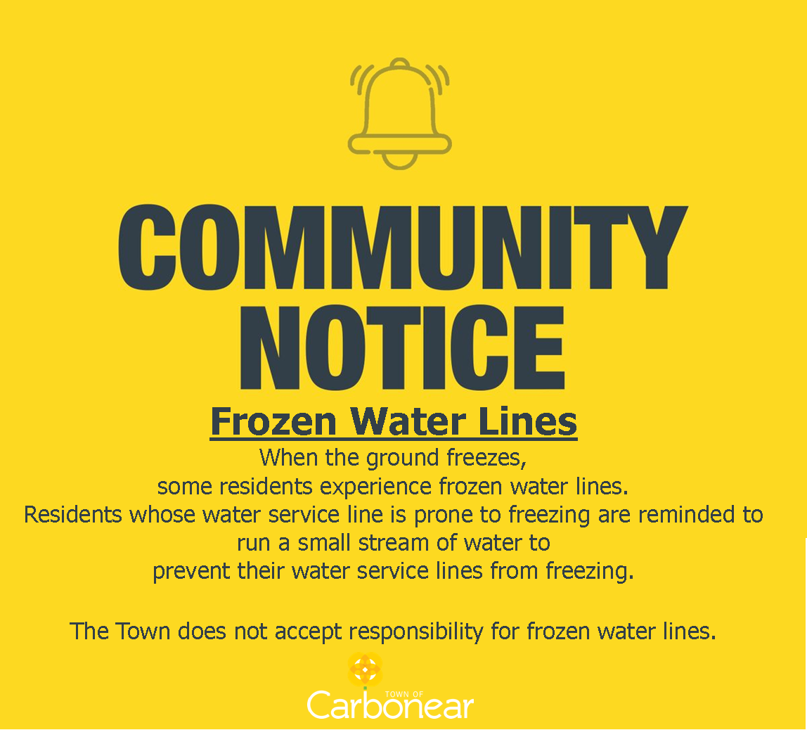
Notice regarding Special Weather Statement issued and Frozen water lines
A Special Weather Statement has been issued for the region. As part of the special weather statement, an extremely cold air mass is expected to move across the Island.
The extremely cold air mass will move over the entire Island Friday night and linger until Sunday when temperatures moderate somewhat. These cold temperatures combined with the strong winds on Saturday will result in dangerous wind chill conditions.
Frozen water lines may occur. Consider regularly running water in your pipes through everyday use, or by continuously running a steady pencil-width stream of water.
5:47 AM NST Thursday 02 February 2023
Special weather statement in effect for:
Avalon Peninsula North
Snow, rain, and strong winds are expected on Friday followed by extreme cold for the weekend.
Locations: Newfoundland.
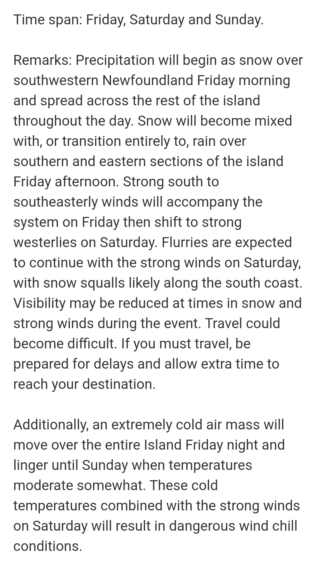
Time span: Friday, Saturday and Sunday.
Remarks: Precipitation will begin as snow over southwestern Newfoundland Friday morning and spread across the rest of the island throughout the day. Snow will become mixed with, or transition entirely to, rain over southern and eastern sections of the island Friday afternoon. Strong south to southeasterly winds will accompany the system on Friday then shift to strong westerlies on Saturday. Flurries are expected to continue with the strong winds on Saturday, with snow squalls likely along the south coast. Visibility may be reduced at times in snow and strong winds during the event. Travel could become difficult. If you must travel, be prepared for delays and allow extra time to reach your destination.
Additionally, an extremely cold air mass will move over the entire Island Friday night and linger until Sunday when temperatures moderate somewhat. These cold temperatures combined with the strong winds on Saturday will result in dangerous wind chill conditions.
Please continue to monitor alerts and forecasts issued by Environment Canada. To report severe weather, send an email to NLstorm@ec.gc.ca or tweet reports using #NLwx.